Vegetation mapping using reflectance data from IKONOS
The images below outline the basic steps which were taken to map the vegetation. Although the images show a small portion of the Mākaha Valley subwatershed, the process was carried out for the entire subwatershed.
Computer analysis involved statistical separation of the pixels based on the reflectance values for all four IKONOS bands. We used an unsupervised classification algorithm to separate unique groups of pixels into landcover classes. Field work was then done in order to match these classes with vegetation communities found in the valley.
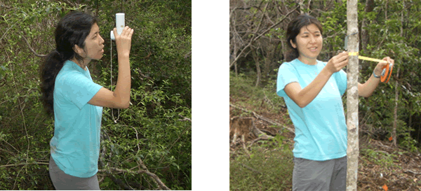
Field data collection involved collecting information on percent cover (below, left picture), diameter at breast height or DBH (below, right picture), slope, and aspect. Observations about the general characteristics of the vegetation were also noted.
Once the initial vegetation map was complete, an accuracy assessment was performed. The vegetation map was compared to another remotely sensed image (Earth Data) in order to see how well our mapped vegetation classes matched with the vegetation in the second image. To learn more about accuracy assessments, please see this overview by the American Museum of Natural History's Biodiversity Informatics Facility.
Map products
Since the IKONOS pixels have a spatial resolution of 4 m x 4 m, the original map had a "salt-and-pepper" appearance, characterized by many small areas of the different landcover classes. In order to remove these areas of isolated pixels, we produced a filtered vegetation map, using majority/minority analysis over a 3 pixel by 3 pixel window. Please see the Vegetation Map Results page for more details.
In addition to the original map and the filtered map, we analyzed vegetation classes based on field data indicating the liklihood of finding native species. Please see the Derived Map Results page for more details about this map.
|