A partnership is formed to protect water resources
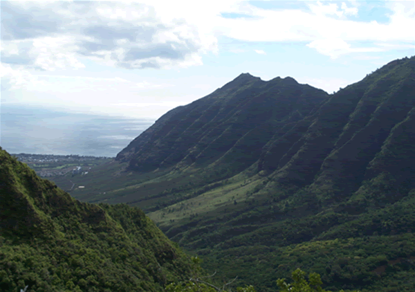
In 2000, the Wai‘anae community group, Mohala i ka Wai, approached the Honolulu Board of Water Supply with a desire to estimate groundwater availability in the Mākaha ahupua‘a. The two formed a partnership and developed the following questions:
1) What is the effect of BWS pumping on stream flow?
2) Are invasive species affecting stream flow?
The partnership sought to involve various groups from the community in water resource management. Our lab at the University of Hawai‘i at Mānoa was tasked to explore the capabilities of remote sensing analysis in the valley. |
Can remote sensing be a useful tool?
Remote sensing is often defined as acquiring information about objects without being in direct physical contact with them. Our ears, eyes, and cameras are examples of remote sensors. More specifically though, remote sensing is the science of collecting and interpreting electromagnetic information about the earth using sensors on platforms in our atmosphere (balloons, airplanes) or in space (satellites).
Our lab was to use remote sensing analysis to map native and invasive communities. Once the map was completed, estimates of water use by native versus invasive communities could be estimated.
The map could also be used for the many conservation projects being conducted in the valley. Although the vegetation of Mākaha has been invaded by numerous nonnative species, many rare Hawaiian plants can still be found at higher elevations. In some places, native species such as ‘ōhi‘a, koa, lama, and ‘ala‘a are common in the overstory and continue to produce healthy keiki. Many organizations are working to protect these special plants.
Read more about the vegetation in Mākaha.
Learn more about invasive species.
Read a short remote sensing introduction.
Exploring the possibilities for mapping Mākaha's vegetation
Remote sensing has been used globally to map invasive species and various vegetation communities. Research in Hawai‘i is still fairly new. The first question we asked was whether invasive species and communities could be separated from Hawaiian species and communities. To address this question, we used a modeling approach.
Explore the model.
Look at some model results with a brief explanation.
Look at additional model results.
Satellite-based mapping of Mākaha's plant communities
Initial information from other sources and our model told us that it would be possible to map native and invasive communities in Mākaha, but to what degree? Remote sensing in tropical areas is complicated by rugged terrain and cloud cover. Could we find data that would allow us to map important areas in Mākaha? Would the highly mixed vegetation in Mākaha make it difficult to separate out certain native or invasive species? We used data from one satellite in order to see what could be possible with real-world vegetation mapping.
See the methods used for our mapping project.
Look at the vegetation map results.
Look at a map derived from the vegetation map.
Key findings
We learned that native Hawaiian and invasive alien vegetation communities can be mapped using available satellite imagery. There are some limitations. For example, the region of the electromagnetic spectrum which the bands are measuring will have a large impact on the accuracy of a mapping project. It is important for resource managers to understand the abilities and limitations of sensors in order to achieve their goals.
More information
For additional information about the topics listed above and more, please take a look at our Links page.
|